



India Map & Capitals 2020

India Map & Capitals 2020 ၏ ရွင္းလင္းခ်က္
This app is useful for every Indian. User Interface is developed very simple for better understanding and good user experience. From this application you can get below maps and information charts.
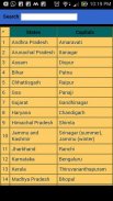
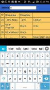
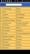
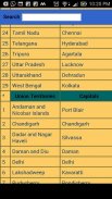
India states and union territories capital cities chart.
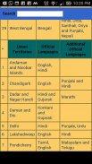
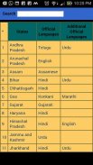
Official languages chart.
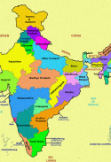
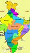
India map.
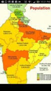
Population map.
Districts and literacy rate information.
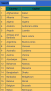
Countries and capitals chart.
Important dates.
India major rivers clear information.
States and capitals quiz game for practice.
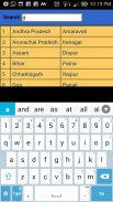
Search option for time saving.
ဒီ app တိုင်းအိန္ဒိယများအတွက်အသုံးဝင်သည်။ User Interface ပိုကောင်းနားလည်မှုနှင့်ကောင်းသောအသုံးပြုသူအတွေ့အကြုံအတွက်အလွန်ရိုးရှင်းတဲ့ဖွံ့ဖြိုးပြီးဖြစ်ပါတယ်။ ဤလျှောက်လွှာကိုမှသင်တို့ကိုမြေပုံများနှင့်သတင်းအချက်အလက်များကိုဇယားအောက်တွင်ဖော်ပြထားသောရနိုင်သည်။
အိန္ဒိယပြည်နယ်နှင့်ပြည်ထောင်စုနယ်မြေများမြို့တော်မြို့ကြီးများနှုန်းပြဇယား။
တရားဝင်ဘာသာစကားများနှုန်းပြဇယား။
အိန္ဒိယမြေပုံကို။
ပြည်သူ့အင်အားမြေပုံ။
ခရိုင်နှင့်စာတတ်မြောက်ရေးနှုန်းသည်သတင်းအချက်အလက်။
နိုင်ငံများနှင့်မြို့တော်ဇယား။
အရေးကြီးရက်စွဲများ။
အိန္ဒိယကိုအဓိကမြစ်များရှင်းရှင်းလင်းလင်းသတင်းအချက်အလက်။
ပြည်နယ်နှင့်အလေ့အကျင့်များအတွက်မြို့တော်ပဟေဠိဂိမ်း။
အချိန်ချွေတာရှာရန် option ကို။


